
Aerial view of apartment buildings
Image
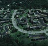
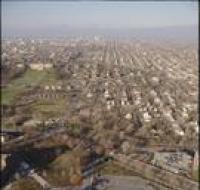
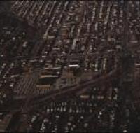
Aerial view of apartment buildings in a suburban area of Kansas City. There are open parking lots in front of each building. There are trees...
Member of
Aerial view of apartment buildings in a suburban area of Kansas City. There are open parking lots in front of each building. There are trees...
Aerial view of the Brush Creek area. The Medical Menorah Center is on the bottom left in between Rockhill Road and Volker Boulevard. Brush Creek...
Aerial view of the Brush Creek area in Kansas City. The corner of Emanuel Cleaver II Boulevard and Troost Avenue is in the center. There are parking...
Aerial view of the Brush Creek area in Kansas City. The Menorah Medical Center is in the bottom center between Rockhill Road and Volker Boulevard...
Aerial view of the Brush Creek area in Kansas City. The Menorah Medical Center is in the center between Rockhill Road and Volker Boulevard. Parking...
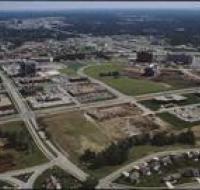
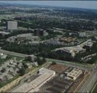
Aerial view of buildings under construction along College Boulevard in Overland Park, Kansas. Several lots are empty and are covered in dirt. There...
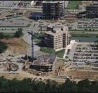
Aerial view of buildings under construction near College Boulevard in Overland Park, Kansas. The building in front has several floors built and a...
Aerial view of Corporate Woods Office Park in Overland Park, Kansas. There are several large office buildings and parking lots. There are...
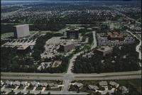
Aerial view of Corporate Woods Office Park in Overland Park, Kansas. There are several large office buildings and parking lots. There are...
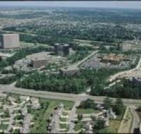
Aerial view of Corporate Woods Office Park in Overland Park, Kansas. There are several large office buildings and parking lots. There are...
Aerial view of Corporate Woods Office Park in Overland Park, Kansas. Several large office buildings and parking lots are along the intersection of...

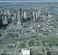
Aerial view of downtown Kansas City near the intersection of Interstate 670 and Highway 71 looking northwest. Interstate 670 passes below road bridges...
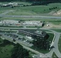
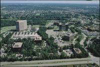
Aerial view of Executive Hills office park in Overland Park along Interstate 435. Houses are being built on the other side of the highway. Several...
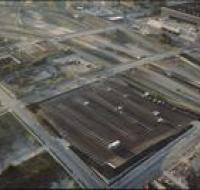
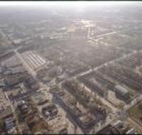
Aerial view of Kansas City above the intersection of Interstates 35 and 670 looking west. Several parking lots and empty lots are below the...
Aerial view of Kansas City above the intersection of Interstates 35 and 670 looking west. Several parking lots and empty lots are below the...
Aerial view of the Manheim neighborhood in Kansas City near Volker Boulevard, Troost Avenue, and Paseo Boulevard. Troost and Paseo are running north...

Aerial view the front lawn of the Nelson-Atkins Museum of Art in Kansas City looking south. The lawn ends at Brush Creek and Volker Boulevard. The...
Aerial view of Pierson Auditorium at the University of Missouri-Kansas City. The auditorium is in a building at the bottom of the photo near a parking...
Aerial view of the neighborhood north of Volker Boulevard between Troost Avenue and Paseo Boulevard. The Menorah Medical Center is at the bottom left...
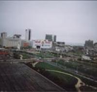
Bird's eye view of Atlantic City; many buildings including Trump Plaza and Caesar's Casino along with a large parking lot and road are seen.
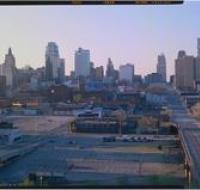
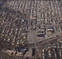
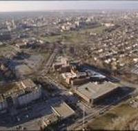
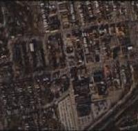
Downtown Kansas as seen looking north from 22nd and Oak. There are several empty parking lots next to a road bridge. There are skyscrapers in the...

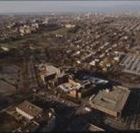
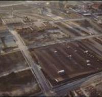
Aerial view of Kansas City above Interstates 35 and 670 looking east. Skyscrapers, parking lots, and downtown Kansas City are visible across from the...
Aerial view of Kansas City above Interstates 35 and 670 looking east. Skyscrapers, parking lots, and downtown Kansas City are visible across from the...

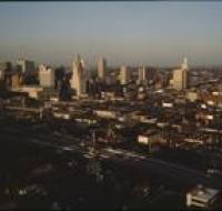
Aerial view of Kansas City above highway 71 looking west. Skyscrapers, parking lots, and downtown Kansas City are visible across from highway 71...
Aerial view of Kansas City above highway 71 looking west. Skyscrapers, parking lots, and downtown Kansas City are visible across from highway 71...