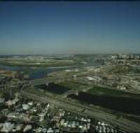
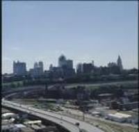
Aerial view of Brush Creek
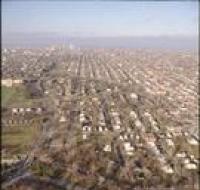
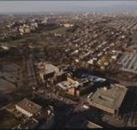
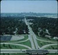
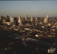
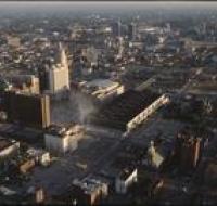
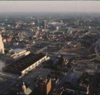
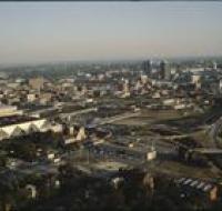
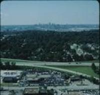
Aerial view of Rockhill Road and Volker Boulevard in Kansas City. The Medical Menorah Center is on the right between both roads. Parking lots for the...
Aerial view of the Brush Creek area in Kansas City. The Menorah Medical Center is in the bottom center between Rockhill Road and Volker Boulevard...
Aerial view of downtown Kansas City looking southwest. There are apartment buildings and warehouses on the other side of a highway from skyscrapers...
Aerial view of downtown Kansas City near the intersection of Interstate 670 and Highway 71 looking northwest. Interstate 670 passes below road bridges...
Aerial view of fields and an industrial park near Kansas City. Skyscrapers and downtown Kansas City are visible on the skyline. A highway is passing...
Aerial view of Kansas City above Interstate 670 looking west. The sun is setting and casting a glare on the photo. Skyscrapers and downtown Kansas...
Aerial view of Kansas City above the intersection of Interstates 35 and 670 looking east. Downtown is on the left, including the Convention Center...
Aerial view of Kansas City above Interstate 35 looking northeast. Skyscrapers, parking lots, and downtown Kansas City are visible in the center. There...
Aerial view of office parks and warehouses near Kansas City. A highway passes along the bottom. Several sets of warehouses are in the center alongside...
Aerial view of Pierson Auditorium at the University of Missouri-Kansas City. The auditorium is in a building at the bottom of the photo near a parking...
Downtown Kansas as seen looking north from 22nd and Oak. There are several empty parking lots next to a road bridge. There are skyscrapers in the...
Aerial view of a highway interchange in front of Kansas City. Skyscrapers and downtown Kansas City are visible in the distance. The highway passes...
Aerial view of Kansas City from above Interstate 35 looking east. The interstate is curving to the left next to a series of railroad tracks...
Aerial view of Kansas City above Interstates 35 and 670 looking east. Skyscrapers, parking lots, and downtown Kansas City are visible across from the...
Aerial view of Kansas City looking southeast. Interstate 670 is passing under several road bridges and intersects with Interstate 35 on the right. The...
Aerial view of the West Bottoms area of Kansas City where the Kansas River and Missouri Rivers converge. Interstates 70 and 35 cross the Kansas River...
Aerial view of warehouses and parking lots in front of Kansas City. Skyscrapers and downtown Kansas City are visible in the distance Cars are parked...
Aerial view looking southeast over Interstate 70 in the West Bottoms area. Skyscrapers and downtown Kansas City are visible in the distance. There are...
Aerial view looking east over Interstate 70 in the West Bottoms area. Skyscrapers and downtown Kansas City are visible in the distance. There are...