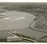
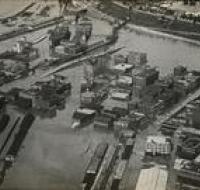
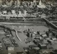
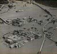
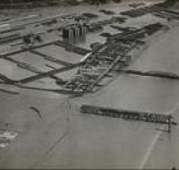
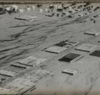
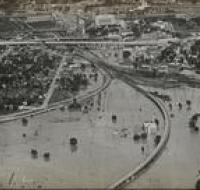
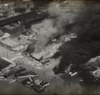
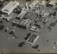
Aerial view of Fairfax District in Kansas City, Ks. Looking southeast
Aerial view of Fairfax District in Kansas City, Kansas looking southeast. Mouth of Kansas River on right; Missouri River at left; Central Industrial...
Aerial view of the confluence of the Missouri and Kansas Rivers from the Kansas side showing the Municipal Wharf, the West Bottoms, and downtown...
Aerial view of the 6th St. interchange looking north.
Aerial photo looking east of the West Bottoms overcome with floodwaters.
Aerial photo looking east of the West Bottoms overcome with floodwaters. Quality Hill can be seen in the background.
View looking east from the Kansas side of the Kaw River of various flooded buildings in Armourdale.
Aerial view of various flooded buildings.
View of Downtown airport from Kansas side of Missouri river. Kansas City Skyline can be seen off in the distance.
Various flooded buildings and industrial tanks.
Flooded train tracks along the Kaw River on the west side of Union Station.
Clouds of billowing dark smoke from burning flooded buildings.
Aerial photo looking north northwest of the Downtown Airport showing flooding of Fairfax in background.