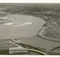
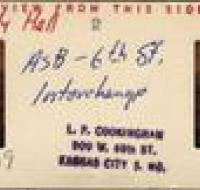
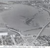
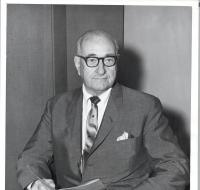
Aerial view of Fairfax District in Kansas City, Ks. Looking southeast
Aerial view of Fairfax District in Kansas City, Kansas looking southeast. Mouth of Kansas River on right; Missouri River at left; Central Industrial District, Mo. in upper right; and Kansas City, Mo...
Aerial view of the confluence of the Missouri and Kansas Rivers
Aerial view of the confluence of the Missouri and Kansas Rivers from the Kansas side showing the Municipal Wharf, the West Bottoms, and downtown Kansas City.
ASB - 6th St. Interchange
Aerial view of the 6th St. interchange looking north.
Grandview Airport from Gen'l Shinglers plane.
Aerial view (looking northwest) of Grandview Airport also known as Richards-Gebaur Airforce Base, wing of airplane take up lower right portion of photograph.
Mid-Cont. Intr. Airport
Aerial view of Mid-Continent International Airport while under construction.
Part of Central Industrial Dist. flooded
Aerial shot of the conjunction of the Kaw and Missouri rivers showing the flooded West Bottoms.