

Aerial view of a highway
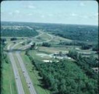
Aerial view of a highway passing by an industrial facility. There are trees on both sides of the highway.
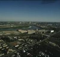
Aerial view of an industrial district
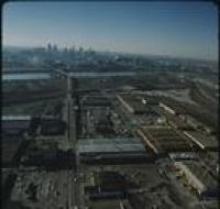
Aerial view of an industrial district north of downtown Kansas City. Several road bridges are crossing the Missouri River. Skyscrapers and downtown are visible in the distance on the other side of the...
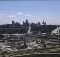
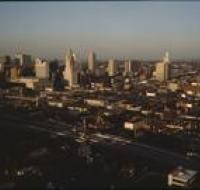
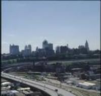
Aerial view of downtown Kansas City
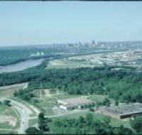
Aerial view of downtown Kansas City looking southwest. The Missouri River passes in front of downtown. Skyscrapers are visible in the distance. Warehouses and industrial facilities are visible in...
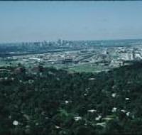
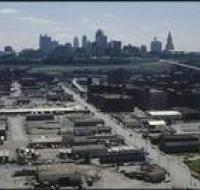
Aerial view of industrial facilities

Aerial view of industrial facilities through a helicopter window. Factories and warehouses are in the foreground. Skyscrapers and downtown Kansas City are in the distance.
Aerial view of industrial facilities
Aerial view of an industrial area near downtown Kansas City. There are houses in between trees at the bottom of the photo. Warehouses and railroad tracks are in front of the downtown area. Skyscrapers...
Aerial view of the Missouri and Kansas Rivers
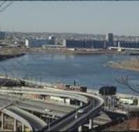
Aerial view of the confluence of the Missouri and Kansas Rivers near the West Bottoms in Kansas City. There is a large factory on the far side of the river. A series of highway ramps are at the bottom...
Aerial view of the Missouri and Kansas Rivers
Aerial view of the confluence of the Missouri and Kansas Rivers near the West Bottoms in Kansas City. There is a large factory on the far side of the river. Smaller warehouses are at the bottom of the...
Aerial view of the Missouri and Kansas Rivers

Aerial view of the confluence of the Missouri and Kansas Rivers near the West Bottoms in Kansas City. There is a large factory on the far side of the river. Smaller warehouses are at the bottom of the...
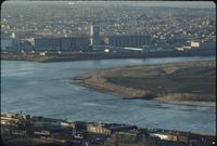
Aerial view of the Missouri and Kansas Rivers
Aerial view of the confluence of the Missouri and Kansas Rivers. Skyscrapers and downtown Kansas City are visible in the distance. A large industrial facility and houses are below the river.
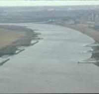
Aerial view of the Missouri River
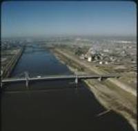
Aerial view of several bridges crossing the Missouri River. Several factories and warehouses are on the right. Trucks and cars are driving across the bridge in front. Other office buildings are on the...
Aerial view of the Missouri River
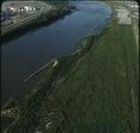
Aerial view of the Missouri River and nearby buildings. There are sandbars and berms along each side of the river. Factories and industrial storage facilities are on the left. A large green field is...
Aerial view of the Missouri River

Aerial view of the Missouri River and nearby buildings. There are sandbars and berms along each side of the river. Factories and industrial storage facilities are on the right. Railroad tracks run...
Aerial view of the Missouri River
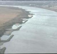
Aerial view of the Missouri River and nearby buildings. There are sandbars and berms along each side of the river. Factories and industrial storage facilities are on the right.
Aerial view of the Missouri River
Aerial view of the Missouri River and nearby buildings. There are sandbars and berms along each side of the river. Factories and industrial storage facilities are on the right.
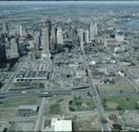
Highway construction near Kansas City
Construction of a highway near downtown Kansas City. Skyscrapers are visible in the distance with one main road passing through the center. A highway is partially constructed on the right. Industrial...
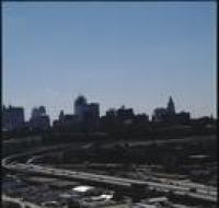
View above Interstate 35
Aerial view of Kansas City from above Interstate 35 looking east. The interstate is curving to the left next to a series of railroad tracks. Industrial facilities are on the right as well. Skyscrapers...
View from Highway 35

Aerial view of Kansas City above Interstates 35 and 670 looking east. Skyscrapers, parking lots, and downtown Kansas City are visible across from the highway The sun is setting and casting large...
View from Highway 35
Aerial view of Kansas City above Interstates 35 and 670 looking east. Skyscrapers, parking lots, and downtown Kansas City are visible across from the highway The sun is setting and casting large...
View from Highway 71

Aerial view of Kansas City above highway 71 looking west. Skyscrapers, parking lots, and downtown Kansas City are visible across from highway 71. Warehouses and factories are on the other side of the...
View from Highway 71
Aerial view of Kansas City above highway 71 looking west. Skyscrapers, parking lots, and downtown Kansas City are visible across from highway 71. Warehouses and factories are on the other side of the...
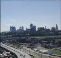
View of the Kansas City skyline
Aerial view of the Kansas City skyline and the West Bottoms area. Factories and warehouses are on both sides of Main Street. Skyscrapers and downtown Kansas City is visible in the distance. There is...
West Bottoms of Kansas City
Aerial view looking southeast over Interstate 70 in the West Bottoms area. Skyscrapers and downtown Kansas City are visible in the distance. There are warehouses and factories near the highway. The...
West Bottoms of Kansas City
Aerial view looking east over Interstate 70 in the West Bottoms area. Skyscrapers and downtown Kansas City are visible in the distance. There are warehouses and factories on both sides of the highway...
West Bottoms of Kansas City
Aerial view looking east over Interstate 70 in the West Bottoms area. Skyscrapers and downtown Kansas City are visible in the distance. There are warehouses and factories on both sides of the highway.
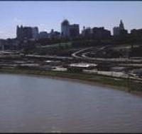
West Bottoms of Kansas City

Aerial view looking southeast over the Missouri River in the West Bottoms area. Skyscrapers and downtown Kansas City are visible in the distance. There are warehouses and factories near Interstate 70...