


Aerial view of Brush Creek
Aerial view of the Brush Creek area. The Medical Menorah Center is on the bottom left in between Rockhill Road and Volker Boulevard. Brush Creek passes through the trees next to Volker. There are...
Aerial view of Brush Creek
Aerial view of Rockhill Road and Volker Boulevard in Kansas City. The Medical Menorah Center is on the right between both roads. Parking lots for the University of Missouri-Kansas City are at the...
Aerial view of Brush Creek

Aerial view of the Brush Creek area in Kansas City. The corner of Emanuel Cleaver II Boulevard and Troost Avenue is in the center. There are parking lots, houses, and apartment buildings around the...
Aerial view of Brush Creek

Aerial view of the Brush Creek area in Kansas City. The Menorah Medical Center is in the bottom center between Rockhill Road and Volker Boulevard. Parking lots and buildings for University of Missouri...
Aerial view of Brush Creek

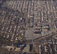
Aerial view of the Brush Creek area in Kansas City. The Menorah Medical Center is in the center between Rockhill Road and Volker Boulevard. Parking lots and buildings for the University of Missouri...
Aerial view of Kansas City
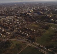
Aerial view of Rockhill, Manheim Park, and Ivanhoe neighborhoods in Kansas City. Volker Boulevard and Brush Creek pass through the middle of the photo. The Menorah Medical Center and University of...
Aerial view of Kansas City
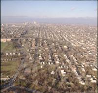
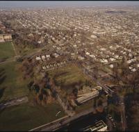
Aerial view of Rockhill, Manheim Park, and Ivanhoe neighborhoods in Kansas City. Volker Boulevard and Brush Creek pass through the middle of the photo. The Menorah Medical Center and University of...
Aerial view of Manheim neighborhood

Aerial view of the Manheim neighborhood in Kansas City near Volker Boulevard, Troost Avenue, and Paseo Boulevard. Troost and Paseo are running north and south near the center of the photo. There are...
Aerial view of Nelson-Atkins lawn
Aerial view the front lawn of the Nelson-Atkins Museum of Art in Kansas City looking south. The lawn ends at Brush Creek and Volker Boulevard. The campus for University of Missouri-Kansas City is on...
Aerial view of the Nelson-Atkins museum

Aerial view of the lawn in front of the Nelson-Atkins Museum in Kansas City. The museum is at the end of a long green lawn. Volker Boulevard and Brush Creek pass along the bottom of the photo. The...
Aerial view of the Nelson-Atkins museum
Aerial view of the lawn in front of the Nelson-Atkins Museum in Kansas City. The museum is at the end of a long green lawn. Volker Boulevard and Brush Creek pass along the bottom of the photo. The...
Aerial view of UMKC

Aerial view of Pierson Auditorium at the University of Missouri-Kansas City. The auditorium is in a building at the bottom of the photo near a parking circle. There are parking lots and other...
Aerial view of Volker Boulevard

Aerial view of the neighborhood north of Volker Boulevard between Troost Avenue and Paseo Boulevard. The Menorah Medical Center is at the bottom left. There are parking lots surrounding the University...
View of Penn Valley area
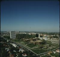
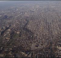
Aerial view of the BMA building, also known as One Park Place, and Penn Valley Community College in the midtown Kansas City area. There are houses along the bottom. Skyscrapers and downtown Kansas...
View of Penn Valley area
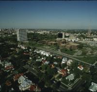
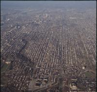
Aerial view of the BMA building, also known as One Park Place, and Penn Valley Community College in the midtown Kansas City area. There are houses along the bottom. Skyscrapers and downtown Kansas...