


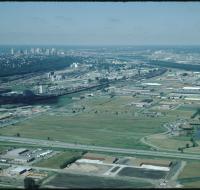
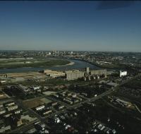
Aerial view of fields
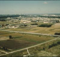
Aerial view of fields and an industrial park near Kansas City. Skyscrapers and downtown Kansas City are visible on the skyline. A highway is passing through the fields. Warehouses are on the other...
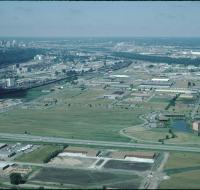
Aerial view of fields
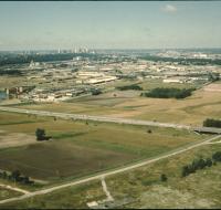
Aerial view of fields and an industrial park near Kansas City. Skyscrapers and downtown Kansas City are visible on the skyline. A highway is passing through the fields. Warehouses are on the other...
Aerial view of hotels and warehouses
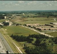
Aerial view of industrial park and motels near Kansas City International Airport. A highway passes along the left next to several large buildings. Warehouses are on the right next to a frontage road...
Aerial view of hotels and warehouses
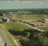
Aerial view of industrial park and motels near Kansas City International Airport. A highway passes along the left next to several large buildings. Warehouses are on the right next to a frontage road...
Aerial view of industrial facilities

Aerial view of an industrial area near downtown Kansas City. There are houses in between trees at the bottom of the photo. Warehouses and railroad tracks are in front of the downtown area. Skyscrapers...
Aerial view of Kansas City
Aerial view of Kansas City from the north. There are open fields and warehouses in the foreground. The Missouri River and downtown Kansas City are in the distance.
Aerial view of Kansas City
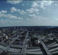
Aerial view of Kansas City looking south from the Power & Light district. Interstate 670 passes underneath several road bridges. Office buildings and warehouses are on the other side of the highway.
Aerial view of Kansas City
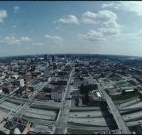
Aerial view of Kansas City looking south from the Power & Light district. Interstate 670 passes underneath several road bridges. Office buildings and warehouses are on the other side of the highway.
Aerial view of Kansas City

Aerial view of Kansas City looking south from the Power & Light district. Interstate 670 passes underneath several road bridges. Office buildings and warehouses are on the other side of the highway.
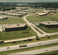
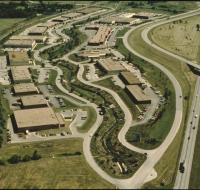
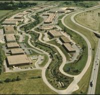
Aerial view of offices and warehouses
Aerial view of office parks and warehouses near Kansas City. A highway passes along the bottom. Several sets of warehouses are in the center alongside roads. Office buildings are along the roads as...
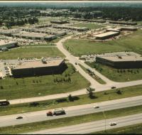
Aerial view of offices and warehouses
Aerial view of office parks and warehouses near Kansas City. A highway passes along the bottom. Several sets of warehouses are in the center alongside roads. Office buildings are along the roads as...
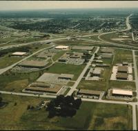
Aerial view of offices and warehouses
Aerial view of office parks and warehouses near Kansas City. A highway passes along the bottom. Several sets of warehouses are in the center alongside roads. Office buildings are along the roads as...
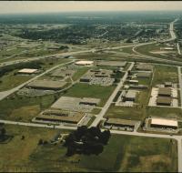
Aerial view of offices and warehouses

Aerial view of office parks and warehouses near Kansas City. A highway passes from the right into the distance. Several sets of warehouses are in the center alongside roads. Office buildings are along...
Aerial view of offices and warehouses
Aerial view of office parks and warehouses near Kansas City. A highway passes from the left into the distance. Several sets of warehouses are in the center alongside roads. Office buildings are along...
Aerial view of offices and warehouses
Aerial view of office parks and warehouses near Kansas City. A highway passes from the left into the distance. Several sets of warehouses are in the center along side roads. Office buildings are along...
Aerial view of the Missouri and Kansas Rivers
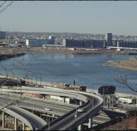
Aerial view of the confluence of the Missouri and Kansas Rivers near the West Bottoms in Kansas City. There is a large factory on the far side of the river. A series of highway ramps are at the bottom...
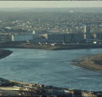
Aerial view of the Missouri and Kansas Rivers
Aerial view of the confluence of the Missouri and Kansas Rivers near the West Bottoms in Kansas City. There is a large factory on the far side of the river. Smaller warehouses are at the bottom of the...
Aerial view of the Missouri and Kansas Rivers
Aerial view of the confluence of the Missouri and Kansas Rivers near the West Bottoms in Kansas City. There is a large factory on the far side of the river. Smaller warehouses are at the bottom of the...
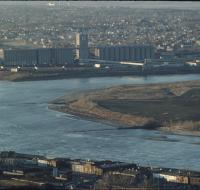
Aerial view of the Missouri and Kansas Rivers
Aerial view of the confluence of the Missouri and Kansas Rivers. Skyscrapers and downtown Kansas City are visible in the distance. A large industrial facility and houses are below the river.
Aerial view of the Missouri River
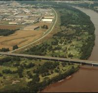
Aerial view of the Missouri River, possibly near River Front street. A road bridge, possibly Couteau Trafficway, stretches across the river. There are warehouses along the left side. There are trees...
Aerial view of warehouses
Aerial view of an industrial park near a highway. Warehouses are scattered along a winding road. Cars are parked in lots next to each building. A highway passes along the right.
Aerial view of warehouses
Aerial view of an industrial park near a highway. Warehouses are scattered along a winding road. Cars are parked in lots next to each building. A highway passes along the right.
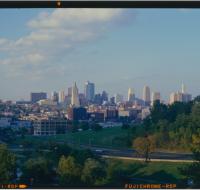
Downtown Kansas City
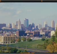
Skyline of downtown Kansas City seen from Penn Valley Park. Skyscrapers are visible across the street. There are also office buildings and warehouses in the distance.
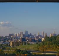
Downtown Kansas City
Skyline of downtown Kansas City seen from Penn Valley Park. Skyscrapers are visible across the street. There are also office buildings and warehouses in the distance.
Downtown Kansas City
Skyline of downtown Kansas City seen from Penn Valley Park. Skyscrapers are visible across the street. There are also office buildings and warehouses in the distance.