

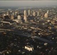
Aerial view of downtown
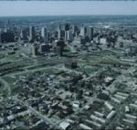
Aerial view of downtown Kansas City looking southwest. There are apartment buildings and warehouses on the other side of a highway from skyscrapers. The Missouri river is passing behind downtown...
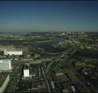
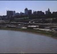
Aerial view of downtown Kansas City
Aerial view of downtown Kansas City looking southwest. The Missouri River passes in front of downtown. Skyscrapers are visible in the distance. Warehouses and industrial facilities are visible in...
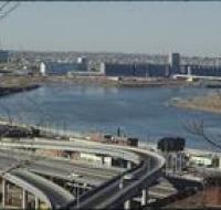
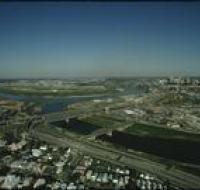
Aerial view of Kansas City
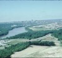
Aerial view of Kansas City above land under development looking south. The Missouri River is passing under a small bridge on the left. Downtown Kansas City is visible in the distance. The area in the...
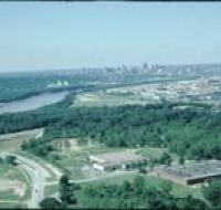
Aerial view of Kansas City
Aerial view of Kansas City from the north. There are open fields and warehouses in the foreground. The Missouri River and downtown Kansas City are in the distance.
Aerial view of Kansas City
Aerial view of Kansas City looking northeast toward downtown. Interstate 35 is passing north over Interstate 670. The Missouri River is visible in the distance on the left. The Convention Center is on...
Aerial view of the Missouri and Kansas Rivers
Aerial view of the confluence of the Missouri and Kansas Rivers. Road bridges are crossing the rivers. Skyscrapers and downtown Kansas City are visible in the distance.
Aerial view of the Missouri and Kansas Rivers
Aerial view of the confluence of the Missouri and Kansas Rivers near the West Bottoms in Kansas City. There is a large factory on the far side of the river. Smaller warehouses are at the bottom of the...
Aerial view of the Missouri and Kansas Rivers
Aerial view of the confluence of the Missouri and Kansas Rivers near the West Bottoms in Kansas City. There is a large factory on the far side of the river. A series of highway ramps are at the bottom...
Aerial view of the Missouri and Kansas Rivers

Aerial view of the confluence of the Missouri and Kansas Rivers near the West Bottoms in Kansas City. There is a large factory on the far side of the river. Smaller warehouses are at the bottom of the...
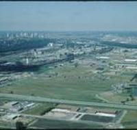
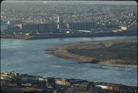
Aerial view of the Missouri River
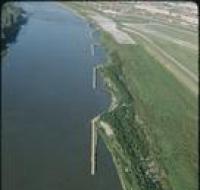
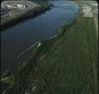
Aerial view of the Missouri River and nearby buildings. There are sandbars and berms along the right side of the river. A runway for Wheeler Airport is on the right. A large green field is in the...
Aerial view of the Missouri River
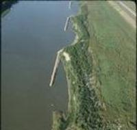
Aerial view of the Missouri River. There are sandbars and berms along the right. A large green field is in the foreground.
Aerial view of the Missouri River
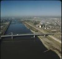
Aerial view of several bridges crossing the Missouri River. Several factories and warehouses are on the right. Trucks and cars are driving across the bridge in front. Other office buildings are on the...
Aerial view of the Missouri River
Aerial view of the Missouri River. There are sandbars and berms along the right. A large green field is in the foreground.
Aerial view of the Missouri River
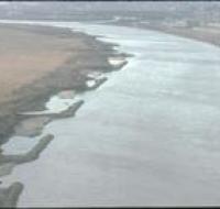
Aerial view of the Missouri River and nearby buildings. There are sandbars and berms along each side of the river. Factories and industrial storage facilities are on the left. A large green field is...
Aerial view of the Missouri River

Aerial view of the Missouri River and nearby buildings. There are sandbars and berms along each side of the river. Factories and industrial storage facilities are on the right. Railroad tracks run...
Aerial view of the Missouri River
Aerial view of the Missouri River and nearby buildings. There are sandbars and berms along each side of the river. Factories and industrial storage facilities are on the right.
Aerial view of the Missouri River
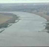
Aerial view of the Missouri River and nearby buildings. There are sandbars and berms along each side of the river. Factories and industrial storage facilities are on the right.
Aerial view of the Missouri River
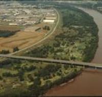
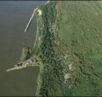
Aerial view of the Missouri River, possibly near River Front street. A road bridge, possibly Couteau Trafficway, stretches across the river. There are warehouses along the left side. There are trees...
View of the West Bottoms
Aerial view of the West Bottoms area of Kansas City where the Kansas River and Missouri Rivers converge. Interstates 70 and 35 cross the Kansas River heading toward downtown Kansas City in the...
West Bottoms of Kansas City
Aerial view looking southeast over Interstate 70 in the West Bottoms area. Skyscrapers and downtown Kansas City are visible in the distance. There are warehouses and factories near the highway. The...
West Bottoms of Kansas City

Aerial view looking southeast over the Missouri River in the West Bottoms area. Skyscrapers and downtown Kansas City are visible in the distance. There are warehouses and factories near Interstate 70...