

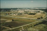
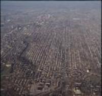
Aerial view of a highway
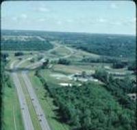
Aerial view of a highway passing by an industrial facility. There are trees on both sides of the highway.
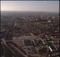
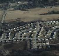
Aerial view of a neighborhood
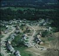
Aerial view of a residential neighborhood under construction in Kansas City. There are houses along two winding streets. The ground on the right is covered in dirt and several construction vehicles...
Aerial view of a railway yard
Aerial view of a highway passing over a railway yard. Trains are parked along several tracks. There are houses at the bottom of the photo.
Aerial view of a railway yard
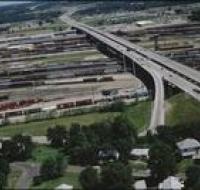
Aerial view of a highway passing over a railway yard. Trains are parked along several tracks. There are houses at the bottom of the photo.
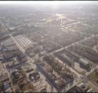
Aerial view of Brush Creek
Aerial view of the Brush Creek area. The Medical Menorah Center is on the bottom left in between Rockhill Road and Volker Boulevard. Brush Creek passes through the trees next to Volker. There are...
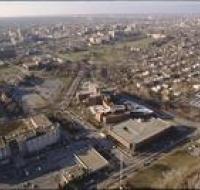
Aerial view of Brush Creek
Aerial view of Rockhill Road and Volker Boulevard in Kansas City. The Medical Menorah Center is on the right between both roads. Parking lots for the University of Missouri-Kansas City are at the...
Aerial view of Brush Creek
Aerial view of the Brush Creek area in Kansas City. The corner of Emanuel Cleaver II Boulevard and Troost Avenue is in the center. There are parking lots, houses, and apartment buildings around the...
Aerial view of Brush Creek
Aerial view of the Brush Creek area in Kansas City. The Menorah Medical Center is in the center between Rockhill Road and Volker Boulevard. Parking lots and buildings for the University of Missouri...
Aerial view of Brush Creek
Aerial view of the Brush Creek area in Kansas City. The Menorah Medical Center is in the bottom center between Rockhill Road and Volker Boulevard. Parking lots and buildings for University of Missouri...
Aerial view of Brush Creek
Aerial view of the Brush Creek area in Kansas City. The Menorah Medical Center is at the bottom left of the photo next to Volker Boulevard. Brush Creek is to the right of Volker. The Nelson-Atkins...
Aerial view of construction

Aerial view of a home under construction. The house is at the end of a road next to another finished house. The neighborhood is surrounded by trees.
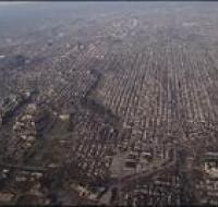
Aerial view of downtown
Aerial view of downtown Kansas City looking southwest. There are apartment buildings and warehouses on the other side of a highway from skyscrapers. The Missouri river is passing behind downtown...
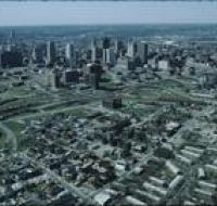
Aerial view of downtown Kansas City

Aerial view of downtown Kansas City near the intersection of Interstate 670 and Highway 71 looking northwest. Interstate 670 passes below road bridges into downtown. Skyscrapers and large parking lots...
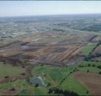
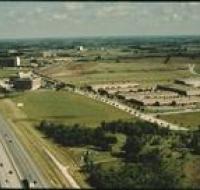
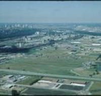
Aerial view of fields
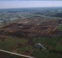
Aerial view of fields along a highway near Kansas City. The highway passes along the upper portion of the photo. Several fields separated by dirt roads. Office buildings and warehouses are on the left...
Aerial view of fields
Aerial view of fields along a highway near Kansas City. The highway passes along the upper portion of the photo. Several fields separated by dirt roads. Office buildings and warehouses are on the left...
Aerial view of fields
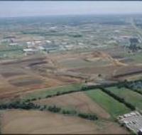
Aerial view of fields along a highway near Kansas City. The highway passes on the right into the distance. Several fields separated by dirt roads are on the left. Office buildings and warehouses are...
Aerial view of fields
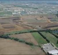
Aerial view of fields along a highway near Kansas City. The highway passes on the right into the distance. Several fields separated by dirt roads are on the left. Office buildings and warehouses are...
Aerial view of fields
Aerial view of fields and an industrial park near Kansas City. Skyscrapers and downtown Kansas City are visible on the skyline. A highway is passing through the fields. Warehouses are on the other...
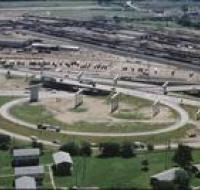
Aerial view of highway construction
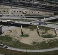
Aerial view of highway construction near Kansas City. A railway yard is above the highway. There are trains parked on all the tracks. There are several concrete pillars in the middle of an off-ramp.
Aerial view of hotels and warehouses
Aerial view of industrial park and motels near Kansas City International Airport. A highway passes along the left next to several large buildings. Warehouses are on the right next to a frontage road...
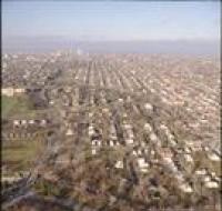
Aerial view of houses
Aerial view of an unidentified housing development near Kansas City. There are houses along several winding roads. The houses are surrounded by open fields.
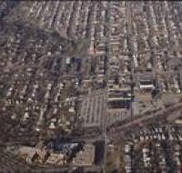
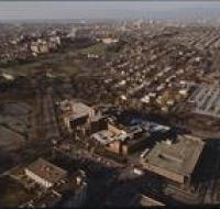
Aerial view of Kansas City
Aerial view of Rockhill, Manheim Park, and Ivanhoe neighborhoods in Kansas City. Volker Boulevard and Brush Creek pass through the middle of the photo. The Menorah Medical Center and University of...
Aerial view of Kansas City
Aerial view of Rockhill, Manheim Park, and Ivanhoe neighborhoods in Kansas City. Volker Boulevard and Brush Creek pass through the middle of the photo. The Menorah Medical Center and University of...
Aerial view of Kansas City

Aerial view of Kansas City above Interstates 35 and 670 looking northeast. Skyscrapers, parking lots, and downtown Kansas City are visible across from the highway. The Convention Center, Municipal...
Aerial view of Kansas City
Aerial view of Kansas City from the north. There are open fields and warehouses in the foreground. The Missouri River and downtown Kansas City are in the distance.