

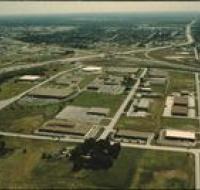
Aerial view of offices and warehouses
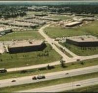
Aerial view of office parks and warehouses near Kansas City. A highway passes along the bottom. Several sets of warehouses are in the center alongside roads. Office buildings are along the roads as...
Aerial view of offices and warehouses
Aerial view of office parks and warehouses near Kansas City. A highway passes from the right into the distance. Several sets of warehouses are in the center alongside roads. Office buildings are along...
Aerial view of offices and warehouses
Aerial view of office parks and warehouses near Kansas City. A highway passes from the left into the distance. Several sets of warehouses are in the center alongside roads. Office buildings are along...
Aerial view of offices and warehouses
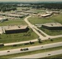
Aerial view of office parks and warehouses near Kansas City. A highway passes along the bottom. Several sets of warehouses are in the center alongside roads. Office buildings are along the roads as...
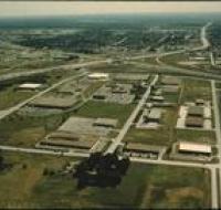
Aerial view of offices and warehouses
Aerial view of office parks and warehouses near Kansas City. A highway passes from the left into the distance. Several sets of warehouses are in the center along side roads. Office buildings are along...
Aerial view of Plaza region

Aerial view the Country Club Plaza region in Kansas City looking north. The Intercontinental hotel is in the center overlooking Brush Creek at the intersection of Volker Boulevard and Wornall Road...
Aerial view of the Kansas River
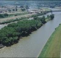
Aerial view of an island in the Kansas River. The island is covered with trees. Behind the island is a railroad bridge crossing the river. There are houses and a water tower on the other side of the...
Aerial view of the Kansas River
Aerial view of an island in the Kansas River. The island is covered with trees. Behind the island is a railroad bridge crossing the river. There are houses and a water tower on the other side of the...
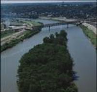
Aerial view of the Missouri and Kansas Rivers
Aerial view of the confluence of the Missouri and Kansas Rivers near the West Bottoms in Kansas City. There is a large factory on the far side of the river. A series of highway ramps are at the bottom...
Aerial view of the Missouri and Kansas Rivers

Aerial view of the confluence of the Missouri and Kansas Rivers near the West Bottoms in Kansas City. There is a large factory on the far side of the river. Smaller warehouses are at the bottom of the...
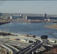
Aerial view of the Missouri River
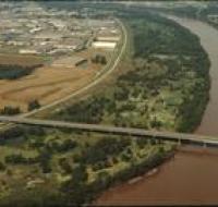
Aerial view of the Missouri River, possibly near River Front street. A road bridge, possibly Couteau Trafficway, stretches across the river. There are warehouses along the left side. There are trees...
Aerial view of the Nelson-Atkins museum
Aerial view of the lawn in front of the Nelson-Atkins Museum in Kansas City. The museum is at the end of a long green lawn. Volker Boulevard and Brush Creek pass along the bottom of the photo. The...
Aerial view of the Nelson-Atkins museum

Aerial view of the lawn in front of the Nelson-Atkins Museum in Kansas City. The museum is at the end of a long green lawn. Volker Boulevard and Brush Creek pass along the bottom of the photo. The...
Aerial view of UMKC
Aerial view of Pierson Auditorium at the University of Missouri-Kansas City. The auditorium is in a building at the bottom of the photo near a parking circle. There are parking lots and other...
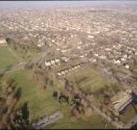
Aerial view of Volker Boulevard
Aerial view of the neighborhood north of Volker Boulevard between Troost Avenue and Paseo Boulevard. The Menorah Medical Center is at the bottom left. There are parking lots surrounding the University...
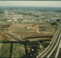
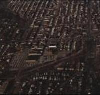
Aerial view of warehouses
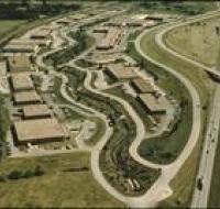
Aerial view of an industrial park near a highway. Warehouses are scattered along a winding road. Cars are parked in lots next to each building. A highway passes along the right.
Aerial view of warehouses
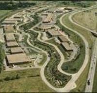
Aerial view of an industrial park near a highway. Warehouses are scattered along a winding road. Cars are parked in lots next to each building. A highway passes along the right.
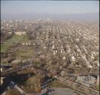
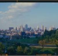
Downtown Kansas City
Skyline of downtown Kansas City seen from Penn Valley Park. Skyscrapers are visible across the street. There are also office buildings and warehouses in the distance.
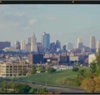
Downtown Kansas City
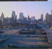
Downtown Kansas as seen looking north from 22nd and Oak. There are several empty parking lots next to a road bridge. There are skyscrapers in the distance behind other office buildings and warehouses.
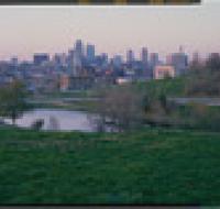
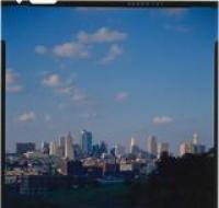
Downtown Kansas City
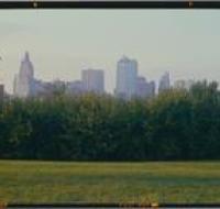
Skyline of downtown Kansas City seen from Penn Valley Park. Skyscrapers are visible behind a row of trees and bushes.
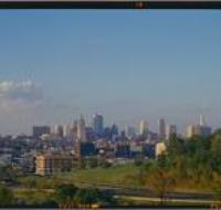
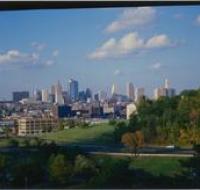
Downtown Kansas City
Skyline of downtown Kansas City seen from Penn Valley Park. Skyscrapers are visible across the street. There are also office buildings and warehouses in the distance.
Downtown Kansas City
Skyline of downtown Kansas City seen from Penn Valley Park. Skyscrapers are visible across the street. There are also office buildings and warehouses in the distance.
Downtown Kansas City
Skyline of downtown Kansas City seen from Penn Valley Park. Skyscrapers are visible across the street. There are also office buildings and warehouses in the distance.
Downtown Kansas City
Skyline of downtown Kansas City seen from Penn Valley Park. Skyscrapers are visible across the street. There are also office buildings and warehouses in the distance.
Downtown Kansas City
Skyline of downtown Kansas City seen from Penn Valley Park. Skyscrapers are visible across the street. There are also office buildings and warehouses in the distance.