

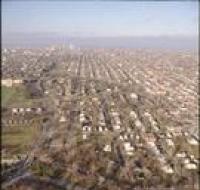
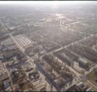
Aerial view of a suburban area
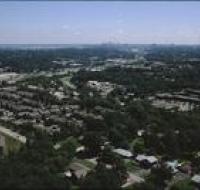
Aerial view of a suburban area near Kansas City. Houses are along several grids of roads. Downtown Kansas City is in the distance along the skyline.
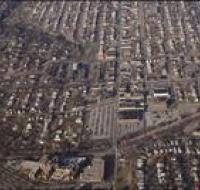
Aerial view of a suburban area
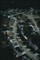
Aerial view of a suburban area near Kansas City. Houses are on both sides of two winding roads. Many lots are still under construction.
Aerial view of a wooded area
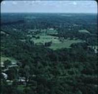
Aerial view of a wooded area near Kansas City. There is a house along a road at the bottom of the photo. There are trees spread throughout.
Aerial view of a wooded area
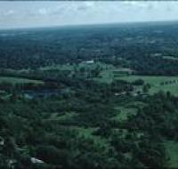
Aerial view of a wooded area near Kansas City. There are houses surrounded by trees at the bottom of the photo.
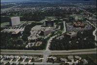
Aerial view of apartment buildings
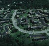
Aerial view of apartment buildings in a suburban area of Kansas City. There are open parking lots in front of each building. There are trees surrounding the buildings.
Aerial view of Brookhollow Industrial Park
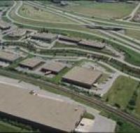
Aerial view of warehouses and Interstate 35 at Brookhollow Industrial Park in Shawnee Mission, Kansas.
Aerial view of Brookhollow Industrial Park

Aerial view of warehouses and Interstate 35 at Brookhollow Industrial Park in Shawnee Mission, Kansas.
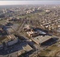
Aerial view of Brush Creek
Aerial view of the Brush Creek area. The Medical Menorah Center is on the bottom left in between Rockhill Road and Volker Boulevard. Brush Creek passes through the trees next to Volker. There are...
Aerial view of Brush Creek
Aerial view of Rockhill Road and Volker Boulevard in Kansas City. The Medical Menorah Center is on the right between both roads. Parking lots for the University of Missouri-Kansas City are at the...
Aerial view of Brush Creek
Aerial view of the Brush Creek area in Kansas City. The corner of Emanuel Cleaver II Boulevard and Troost Avenue is in the center. There are parking lots, houses, and apartment buildings around the...
Aerial view of Brush Creek
Aerial view of the Brush Creek area in Kansas City. The Menorah Medical Center is in the center between Rockhill Road and Volker Boulevard. Parking lots and buildings for the University of Missouri...
Aerial view of Brush Creek
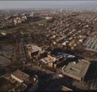
Aerial view of the Brush Creek area in Kansas City. The Menorah Medical Center is in the bottom center between Rockhill Road and Volker Boulevard. Parking lots and buildings for University of Missouri...
Aerial view of Brush Creek
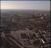
Aerial view of the Brush Creek area in Kansas City. The Menorah Medical Center is at the bottom left of the photo next to Volker Boulevard. Brush Creek is to the right of Volker. The Nelson-Atkins...
Aerial view of College Boulevard
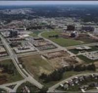
Aerial view of buildings under construction along College Boulevard in Overland Park, Kansas. Several lots are empty and are covered in dirt. There are office buildings, warehouses, and parking lots...
Aerial view of construction
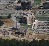
Aerial view of buildings under construction near College Boulevard in Overland Park, Kansas. The building in front has several floors built and a crane is raised overhead. There are parking lots full...
Aerial view of construction

Aerial view of a home under construction. The house is at the end of a road next to another finished house. The neighborhood is surrounded by trees.
Aerial view of Corporate Woods Office Park
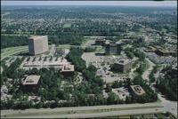
Aerial view of Corporate Woods Office Park in Overland Park, Kansas. There are several large office buildings and parking lots. There are neighborhoods of houses along winding roads in the distance.
Aerial view of Corporate Woods Office Park
Aerial view of Corporate Woods Office Park in Overland Park, Kansas. There are several large office buildings and parking lots. There are neighborhoods of houses along winding roads in the distance.
Aerial view of Corporate Woods Office Park
Aerial view of Corporate Woods Office Park in Overland Park, Kansas. There are several large office buildings and parking lots. There are neighborhoods of houses along winding roads in the distance.
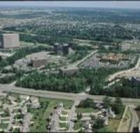
Aerial view of Corporate Woods Office Park
Aerial view of Corporate Woods Office Park in Overland Park, Kansas. Several large office buildings and parking lots are along the intersection of College Park and Antioch Road. There are...
Aerial view of downtown
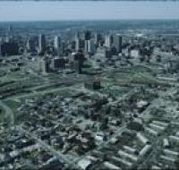
Aerial view of downtown Kansas City looking southwest. There are apartment buildings and warehouses on the other side of a highway from skyscrapers. The Missouri river is passing behind downtown...
Aerial view of downtown Kansas City
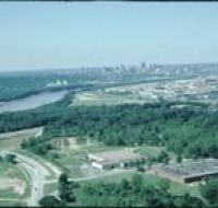
Aerial view of downtown Kansas City looking southwest. The Missouri River passes in front of downtown. Skyscrapers are visible in the distance. Warehouses and industrial facilities are visible in...
Aerial view of downtown Kansas City

Aerial view of downtown Kansas City near the intersection of Interstate 670 and Highway 71 looking northwest. Interstate 670 passes below road bridges into downtown. Skyscrapers and large parking lots...
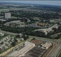
Aerial view of Executive Hills
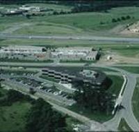
Aerial view of Executive Hills office park in Overland Park along Interstate 435. Houses are being built on the other side of the highway. Several office buildings and parking lots are below the...
Aerial view of fields

Aerial view of fields near Kansas City. The fields are covered in freshly tilled dirt. There are groves of trees between various fields.