

Aerial view above Wheeler Airport

Aerial view above Wheeler Airport in Kansas City, Missouri, overlooking the confluence of the Missouri and Kansas Rivers. A road bridge is crossing the Kansas River. Several small planes are parked...
Aerial view above Wheeler Airport
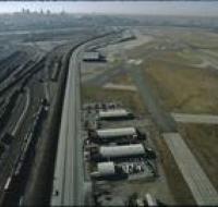
Aerial view above Wheeler Airport in Kansas City, Missouri. Two airport runways are on the right next to several terminal buildings. Trains are moving along a network of railroad tracks on the left...
Aerial view of a railway yard
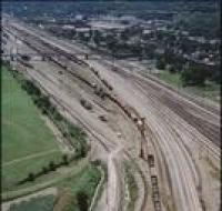
Aerial view of a railway yard near Kansas City. Two trains are on the tracks. A bridge passes over the tracks. There are warehouses on the other side of the tracks.
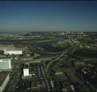
Aerial view of an industrial district
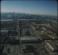
Aerial view of an industrial district north of downtown Kansas City. Several road bridges are crossing the Missouri River. Skyscrapers and downtown are visible in the distance on the other side of the...
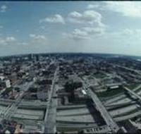
Aerial view of downtown
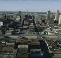
Aerial view of downtown Kansas City looking north above Interstate 670. The highway passes underneath several road bridges. There are over a dozen skyscrapers north of the highway. The Missouri River...
Aerial view of Kansas City
Aerial view of Kansas City looking south from the Power & Light district. Interstate 670 passes underneath several road bridges. Office buildings and warehouses are on the other side of the highway.
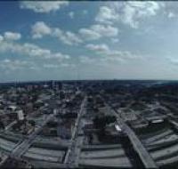
Aerial view of Kansas City
Aerial view of Kansas City looking south from the Power & Light district. Interstate 670 passes underneath several road bridges. Office buildings and warehouses are on the other side of the highway.
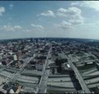
Aerial view of Kansas City
Aerial view of Kansas City looking south from the Power & Light district. Interstate 670 passes underneath several road bridges. Office buildings and warehouses are on the other side of the highway.
Aerial view of Kansas City
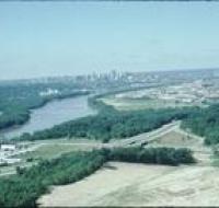
Aerial view of Kansas City above land under development looking south. The Missouri River is passing under a small bridge on the left. Downtown Kansas City is visible in the distance. The area in the...
Aerial view of the Kansas River
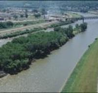
Aerial view of an island in the Kansas River. The island is covered with trees. Behind the island is a railroad bridge crossing the river. There are houses and a water tower on the other side of the...
Aerial view of the Kansas River
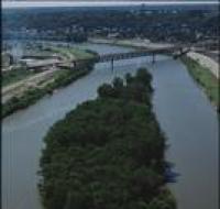
Aerial view of an island in the Kansas River. The island is covered with trees. Behind the island is a railroad bridge crossing the river. There are houses and a water tower on the other side of the...
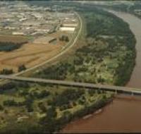
Aerial view of the Missouri and Kansas Rivers
Aerial view of the confluence of the Missouri and Kansas Rivers. Road bridges are crossing the rivers. Skyscrapers and downtown Kansas City are visible in the distance.
Aerial view of the Missouri River
Aerial view of several bridges crossing the Missouri River. Several factories and warehouses are on the right. Trucks and cars are driving across the bridge in front. Other office buildings are on the...
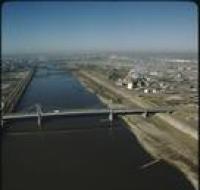
Aerial view of the Missouri River
Aerial view of the Missouri River, possibly near River Front street. A road bridge, possibly Couteau Trafficway, stretches across the river. There are warehouses along the left side. There are trees...
View of the Kansas City skyline
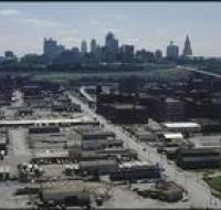
Aerial view of the Kansas City skyline and the West Bottoms area. Factories and warehouses are on both sides of Main Street. Skyscrapers and downtown Kansas City is visible in the distance. There is...