

Aerial view above Wheeler Airport

Aerial view above Wheeler Airport in Kansas City, Missouri, overlooking the confluence of the Missouri and Kansas Rivers. A road bridge is crossing the Kansas River. Several small planes are parked...
Aerial view above Wheeler Airport
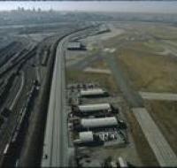
Aerial view above Wheeler Airport in Kansas City, Missouri. Two airport runways are on the right next to several terminal buildings. Trains are moving along a network of railroad tracks on the left...
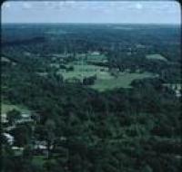
Aerial view of a clubhouse
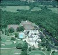
Aerial view of a clubhouse of a golf course with pool, and tennis courts. The clubhouse is surrounded by trees and open fields. There are two parking lots on the right with parked cars.
Aerial view of a field
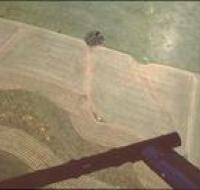
Aerial view of the plowed field near Kansas City. The landing skids of the helicopter are in the bottom of the photo as well.
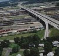
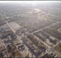
Aerial view of a highway
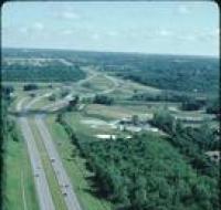
Aerial view of a highway passing by an industrial facility. There are trees on both sides of the highway.
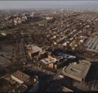
Aerial view of a neighborhood
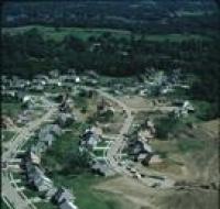
Aerial view of a residential neighborhood under construction in Kansas City. There are houses along two winding streets. The ground on the right is covered in dirt and several construction vehicles...
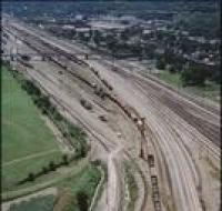
Aerial view of a railway yard
Aerial view of a highway passing over a railway yard. Trains are parked along several tracks. There are houses at the bottom of the photo.
Aerial view of a railway yard
Aerial view of a highway passing over a railway yard. Trains are parked along several tracks. There are houses at the bottom of the photo.
Aerial view of a railway yard
Aerial view of a railway yard near Kansas City. Two trains are on the tracks. A bridge passes over the tracks. There are warehouses on the other side of the tracks.
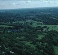
Aerial view of a wooded area
Aerial view of a wooded area near Kansas City. There is a house along a road at the bottom of the photo. There are trees spread throughout.
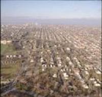
Aerial view of a wooded area
Aerial view of a wooded area near Kansas City. There are houses surrounded by trees at the bottom of the photo.
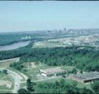
Aerial view of an industrial area
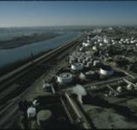
Aerial view of an industrial area along the Missouri River. Storage tanks are scattered along lots next to a railroad line that runs parallel to the river. Skyscrapers and downtown Kansas City are...
Aerial view of an industrial district
Aerial view of an industrial district north of downtown Kansas City. Several road bridges are crossing the Missouri River. Skyscrapers and downtown are visible in the distance on the other side of the...
Aerial view of Brush Creek
Aerial view of the Brush Creek area. The Medical Menorah Center is on the bottom left in between Rockhill Road and Volker Boulevard. Brush Creek passes through the trees next to Volker. There are...
Aerial view of Brush Creek
Aerial view of Rockhill Road and Volker Boulevard in Kansas City. The Medical Menorah Center is on the right between both roads. Parking lots for the University of Missouri-Kansas City are at the...
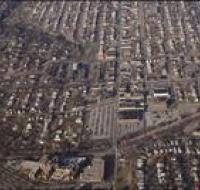
Aerial view of Brush Creek
Aerial view of the Brush Creek area in Kansas City. The corner of Emanuel Cleaver II Boulevard and Troost Avenue is in the center. There are parking lots, houses, and apartment buildings around the...
Aerial view of Brush Creek
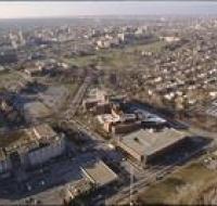
Aerial view of the Brush Creek area in Kansas City. The Menorah Medical Center is in the center between Rockhill Road and Volker Boulevard. Parking lots and buildings for the University of Missouri...
Aerial view of Brush Creek
Aerial view of the Brush Creek area in Kansas City. The Menorah Medical Center is in the bottom center between Rockhill Road and Volker Boulevard. Parking lots and buildings for University of Missouri...
Aerial view of Brush Creek
Aerial view of the Brush Creek area in Kansas City. The Menorah Medical Center is at the bottom left of the photo next to Volker Boulevard. Brush Creek is to the right of Volker. The Nelson-Atkins...
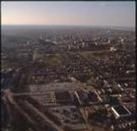
Aerial view of construction

Aerial view of a home under construction. The house is at the end of a road next to another finished house. The neighborhood is surrounded by trees.
Aerial view of downtown
Aerial view of downtown Kansas City looking north above Interstate 670. The highway passes underneath several road bridges. There are over a dozen skyscrapers north of the highway. The Missouri River...
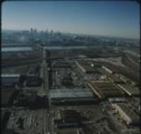
Aerial view of downtown
Aerial view of downtown Kansas City looking southwest. There are apartment buildings and warehouses on the other side of a highway from skyscrapers. The Missouri river is passing behind downtown...
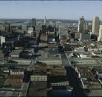
Aerial view of downtown Kansas City

Aerial view of downtown Kansas City. Skyscrapers are surrounded by dozens of blocks with retail and office buildings. Interstate 670 passes in front of the skyscrapers. The Missouri River is in the...
Aerial view of downtown Kansas City

Aerial view of downtown Kansas City. Skyscrapers are surrounded by dozens of blocks with retail and office buildings. Interstate 670 passes in front of the skyscrapers. The Missouri River is in the...
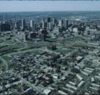
Aerial view of downtown Kansas City
Aerial view of downtown Kansas City looking southwest. The Missouri River passes in front of downtown. Skyscrapers are visible in the distance. Warehouses and industrial facilities are visible in...